Agrinio
Advertisement
By Air
Agrinio's airport is located near the city, in the area of Dokimi.IATA code: AGQ, ICAO: LGAG.The airport hosts the Agrinion aeroclub Agrinion Aeroclub.From the national road when you are outside Agrinion you take the turn to Dokimi and follow the road. When you will see a kiosk to the right slow down gradually and watch to the left. You will see a plate with an arrow showing the way to Agrinion Aeroclub.You turn to the left and you will see the airport.
By Road
Agrinio is linked with the rest of the country by the GR-5/E55 which since the 1960s passes from Agrinion and the GR-38/E862 leading to Karpenisi and Lamia to the east.The city is located NW of the Rio–Antirrio bridge and Patras, N of Messolonghi, NE of Astakos, E-SE of Lefkada and Preveza, S of Arta and Ioannina and W-SW of Karpenisi and Lamia.Since 2009 a part of the new Ionia Odos which bypasses Agrinio is constructed from the village of Kefalovryso in the south to Lake Ozeros in the north.
Papastratio City park
The Papastratio is large city park in the center of Agrinio.In 1919 the Brothers Papastratou bought an area of 54 acres in the then city limits of Agrinio and shaped to become a recreation area for residents of Agrinio.Today the land was owned by the municipality of Agrinio, mainly in spring and summer, hosting many cultural, theatrical and musical events.Inside the park is open anapsyktirio.I old name of the part is now the Park was Papastratio "Lykorachia".Formerly the estate of the family of Agrinioti poet Kostas Hatzopoulos.
Archaeological Museum of Agrinio
is located in Agrinio area near the Municipal Park of the city and includes findings from the prehistoric to the Roman era as the area of Agrinio and the ancient city and from the entire county Aitoloakarnanias.Housed in a building built in 1960 and donated the brothers Papastratou.
Holy Trinity of Black
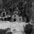
The Trinity in Black is a Byzantine church dating back to around the 9th century and is located within the City of Agrinio and within walking distance from Lake Lysimachia.Today is misovythismenos because of silting for centuries gathered on the shores of the lake excavation works carried out by the University of Ioannina.The aim is the final removal of water from the temple area and seal - highlighting the monument.
Musty Missolonghi
Millions of years ago the basin formed by the mountains Arakynthos and Panaitoliko was a huge lake which poured a river Achelous.This huge quantity of water ran through the canyon Klisoura and poured in the lagoon of Etolikou.Over the centuries and after geological upheavals in the region the river changed course leading to the canyon Klisoura be a dry riverbed and the remains of the huge lake that existed in form of lakes Trichonida, Ozeros, Amvrakia and Lysimachia.
The Ancient Stratos
Ancient Stratos located north of the modern village built in the West bank of the Achelous, which was the natural boundary between Aetolia and Acarnania.To say that Achelous was navigable during the Classical and Hellenistic periods (up to Oiniades) as witnessed by the riverside southwest gate of the town on the highway.The Stratos was one of the largest and best fortified cities Akarnanias.O Hill Stratos was inhabited from the Late period (1600-1100 BC).Gained importance due to its geo-strategic position in the 4th century BC when it was capital of the Commonwealth of Acarnania to the 2nd century. BC, when the position taken by the Thyrreio.In the fifth and fourth centuries.BC flourished as a commercial center.The city and ancient authors mention the importance of having been one of the largest and best fortified cities.
November - February
April - July


